
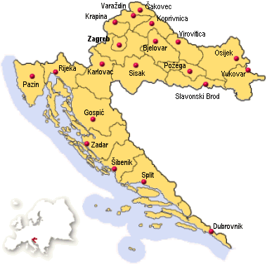
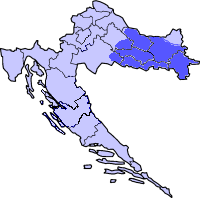
Map of Croatia Today
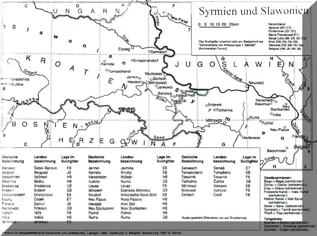
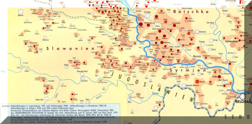
Hans Gehl – Map of Settlements in Syrmien and Slavonia
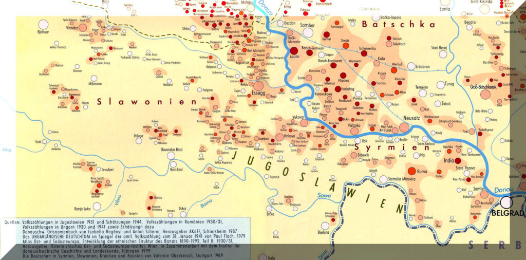
Magdalena Kopp – Map of Settlements in Syrmien and Slavonia
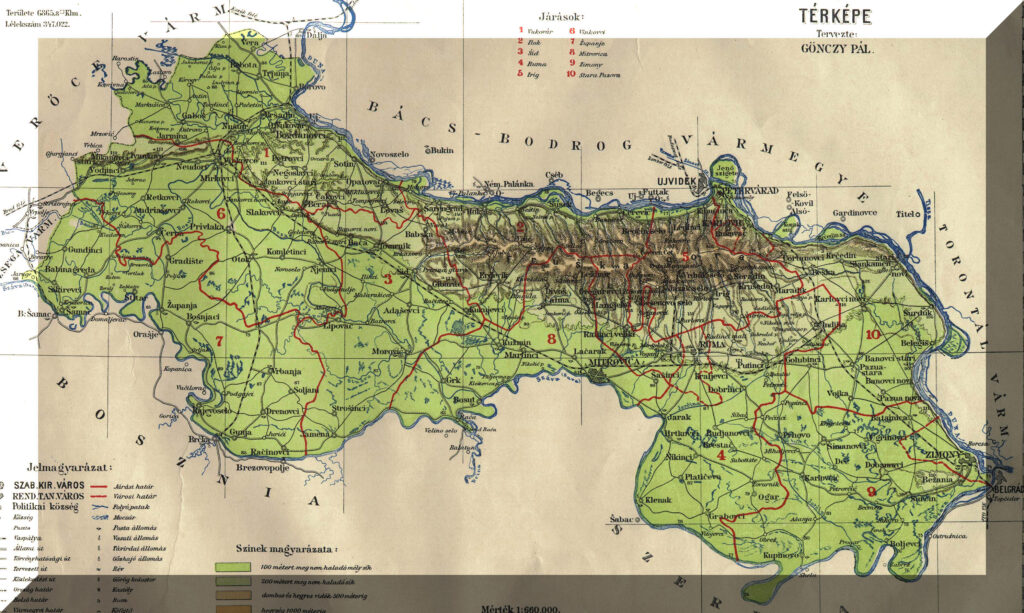
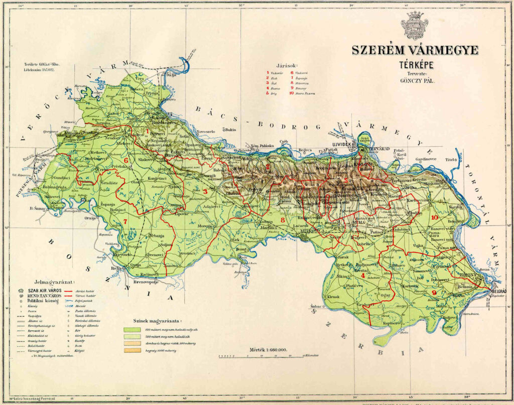
Map of Szerem
Austria-Hungary Maps
Note: find the link above — maybe it is Austria-Hungary Maps & Atlases????
Kingdom of Slavonia & Slavonia Krajina
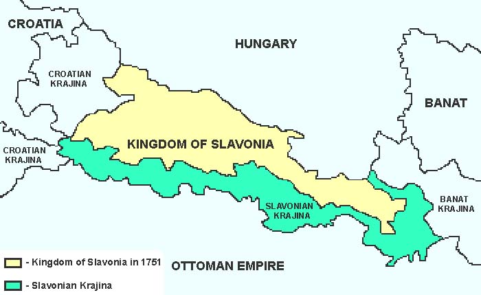
After the World War I, Hungary surrendered Slavonia to the newly-formed Yugoslavia as part of the Treaty of Trianon (June 4, 1920). It was not merged back into Hungary during the years 1941-44 as other neighboring regions were. Following World War II, Slavonia with Croatia, Austrian Dalmatia, southern Istria and southern Baranya, but not Syrmia (Srem), establishing the state of Croatia within the Yugoslavian nation. As of May 19, 1991, these areas, including Slavonia, became the new nation of Croatia.
1751 – Kingdom of Slavonia
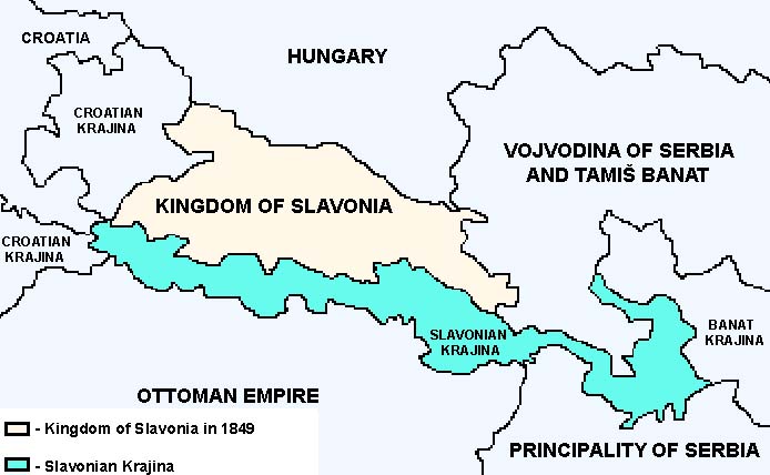
1849 – Kingdom of Slavonia
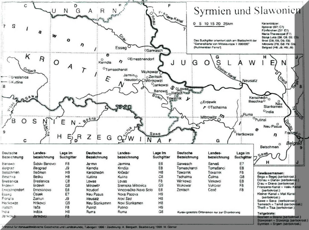
1999 – Syrmia & Slavonia
Reproduced with the permission of the author from the book
“Donauschwäbische Lebensformen an der Mittleren Donau” by Hans Gehl, Marburg 2003.
© Institut für donauschwäbische Geschichte und Landeskunde, Tübingen 1996
© N.G. Elwert Verlag Marburg.
Click image to enlarge.
Syrmia & Slavonia Village Map
1930-1944
Historic Settlement Map of the Danube Swabian by Hans Sonnleitner & Magdalena Kopp-Krumes;
Copyrighted Danube-Swabian Culture Foundation (Brochure – April 2004, out of print) –
Contributed by Hans Kopp, with permission of by Ernst Jaeger.
Click map to enlarge.
Croatia with Slavonia highlighted
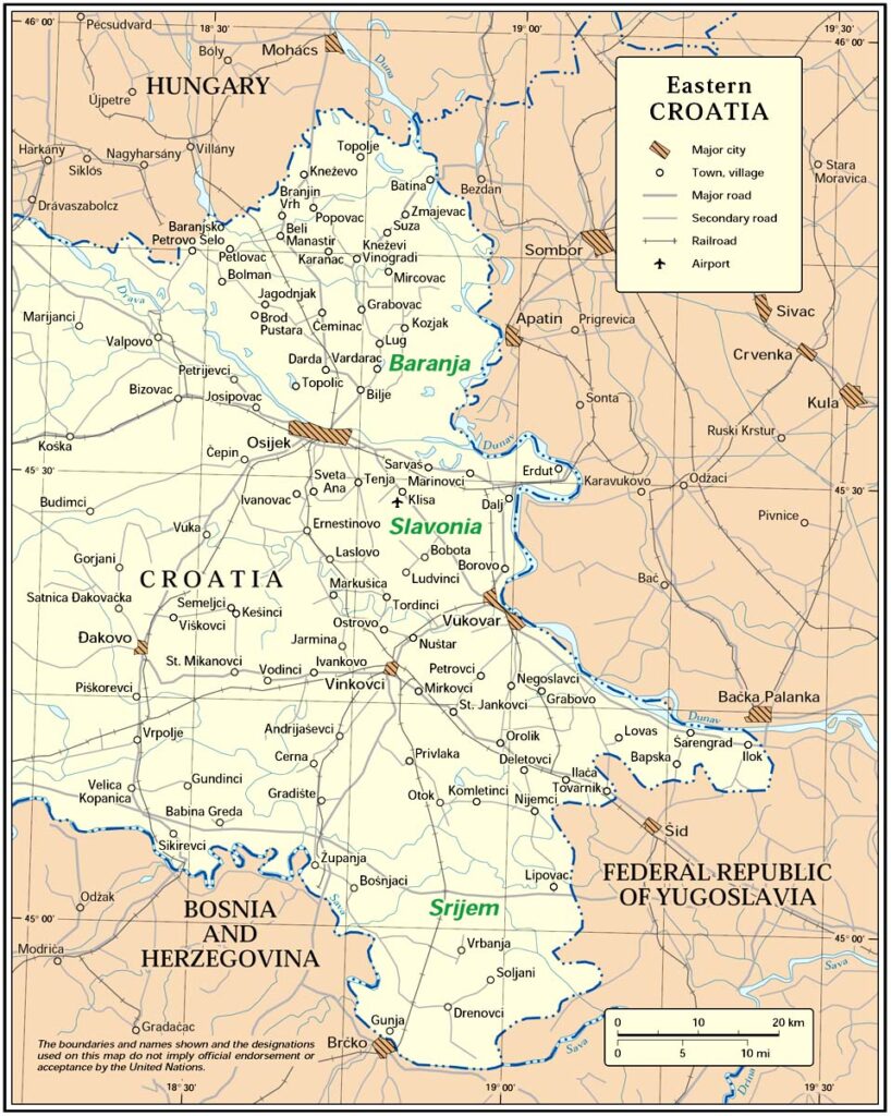
Eastern Croatia
Slavonia
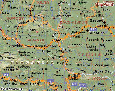
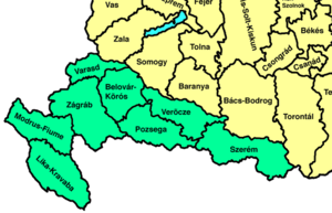
1910 map of Syrmien / Szerem
Slawonien Map
Croatian Homepage w/Map
www.euratlas.net/cartogra/deutschland/germany_4-3.jpg –
Post road and railroad map of Germany, Holland, Belgium, Switzerland, Italy to Naples, the largest part of France, Hungary, Poland etc.
with a special attention drawn to railways and sea routes.
Printed in Nuremberg in 1852.
Last updated: 09/28/2026